Thursday, November 21, 2013

Eastatoe Heritage Preserve


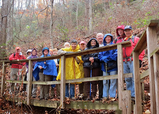
 The weather was iffy today with a slight drizzle of a rain when I headed out to meet the group. No word of cancellation, so off I go with my rain gear in pack. I've done this hike before 2 years ago with Mandy. My pedometer read 6.5 of this easy to moderate hike. The trail leads to a pristine mountain gorge, falls and a bold stream. We begin at the Laurel Fork Foothills access along the Horsepasture Road for a quarter mile then head south 1.9 miles on an old logging road. The trail then drops about 900 ft into the gorge with several switchbacks and stairways along the way. Near the gorge bottom, a 0.2 mile spur to the right leads to an overlook and scenic falls. On the return, we followed the creek up steam for half a mile for lunch on the rocks at the rapids.


NOTES: From Holly Springs Mart on Hwy 11 and US178, go 8 miles north on US178 through Rocky Bottom. Then, just over the bridge across Eastatoe Creek, turn sharp left onto Laurel Valley Road. Immediately bear right following the graveled Horsepasture Road uphill another quarter mile to the Foothills parking area and kiosk.
Tuesday, November 19, 2013

Table Rock (the dreaded hike)


I've passed on this hike 3 times for the mere reason I didn't think I could do it. This hike is rated difficult due to the climb of 2000 feet. We started out on the red-blazed trail which begins at Carrick Creek Nature Center. The pathways are rocky with rock steps through open forest strewn with huge boulders. There were many places to stop and rest and I wasn't the only one making those stops.

The shelter at about the half way point has a spectacular view but none like we saw from Governor's Rock and from the Table Rock Cliff. Legend says errant Indians were thrown to their death here.


View from Covered Shelter at half way point


One of the views from Table Rock

A new friend!


Governor's Rock


Spaghetti legs by now!

From my pedometer readings we reached Governor's Rock at the 3.4 mile mark and 4.3 mark at Table Rock Cliff. A definite longest hike for me of 8.6 and very difficult. At this point, not sure if I'll do it again, but I'm glad I can say I DID IT!

NOTES: From Holly Springs Mart off Hwy 11 and 178, follow Hwy 11 NE for 5 miles to the West Gate of Table Rock State Park. Stop at gate for pay pass and follow road up to the main parking lot and Nature Center.

Tuesday, November 12, 2013

Hickorynut via Sassafras Mountain


The forecast today was great for this hike with low am temps of 35 but reached 65 by lunch. Started from 3550 ft summit of Sassafras Mountain with a quick peek at the overlook....a little windy but had a pretty good vista. First hike I've done being the only female. From the summit you follow the Foothills trail toward Table Rock....a little confusing a first because we started on the wrong trail but quickly realized our error.


I couldn't get a picture of all the lakes at once but you
can see Hartwell, Keowee and Jocassee from this point.
After about a mile or so we passed the remnants of the John Cantrell homesite and decided this would be the perfect place for our lunch on the return.


About a mile beyond this point is Hickorynut Mountain Gap....this is a gradual decent and we continued until we had the view of Pinnacle Mtn in our site where we did our turnaround making this a 6 mile mostly moderate hike with about 650 ft of elevation gain.

Where is Tarzen?


NOTES: From Holly Springs Mart off Hwy 11 and US 178, follow 178 for 7.2 miles to Rocky Bottom. Bear right on Vanclayton/Sassafras Mtn. Rd and continue for about 4 miles to parking at the summit.

Friday, November 8, 2013

Long Creek and Raven Cliff (Deliverance Rock)


Missed a few hikes in the last two weeks so I was anxious to get out into the woods. Since our Thursday hike was cancelled due to weather, Bill decided to schedule the hike for Friday. So glad I was feeling better and didn't have anything pressing that would have prevented me from hiking this day. After doing some research to see if I had been on the Long Creek hike before, I discovered the directions to the trail head was familiar but the surroundings from the previous year pictures was not. It wasn't till after the hike today and driving back out that I saw a sign that read "Trail to Opossum Falls" (my first hike with the group 3 years ago)....so I had been in the area but not on this particular hike. Twelve of us gather at the usual meeting place and off we go. A little bit of a turn here and there, but we found the trail head. NOTE DRIVING TO TRAIL HEAD: Follow gravel Turkey Ridge Road till the end and trail head will be on an old maintenance road. Just a short distance on the hike, the road veers off to left (this will be way to Raven Cliff). No markings to speak of, so we just had to relay on past experiences on this trial. We hiked for approximately one mile before reaching the view of the Chattoogo River/Raven Cliff/Deliverance Rock. What a site to see.
After the specular view we returned back to the main trail and headed to Long Creek Falls. Our leaders' memorary was a little off, and led us off the path but shortly most of us turned back and found the correct trail to the river. It was such a beautful day, no one seemed to care about the extra scramble.

Long Creek Falls - leads into Chattooga River Section IV


After our usually picnic lunch we scrambled back up the hill and found our other group pondering on if they had missed us.